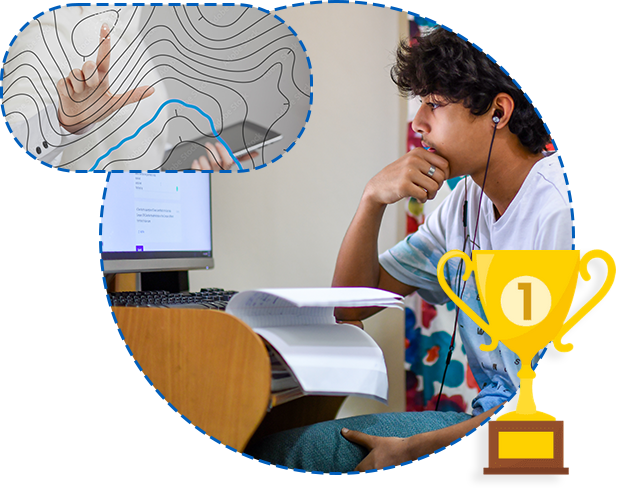
Master Mentors Geo-enabling Indian Scholars (MMGEIS), an online program aims to inculcate geospatial thinking and develop a research-oriented mindset amongst students who will form the future workforce of the country. The program will be open to students from 8th grade to undergraduate and will be delivered in a completely virtual mode over 4 months to provide them with much-needed exposure about what goes behind the common apps that we use to navigate our way to someplace or hail a cab or order food or other stuff from our mobile devices, or how GIS and remote sensing is playing a role in smart cities, utilities, transportation, disaster management, sustainable development etc. It is about kindling geospatial thinking which will become foundation for them to use the geospatial approach in which ever career they adopt.
Member Space Commission and Former Chairman, ISRO
Shri A.S. Kiran Kumar is currently a member of the Space Commission. He was also the former Chairman of ISRO from 2015-2018. He is a highly accomplished space scientist and engineer with a distinguished career spanning over four decades in ISRO in the satellite payload and applications domains. He has made immense contributions to the design and development of Electro-Optical Imaging Sensors for Airborne, Low Earth Orbit and Geostationary Orbit satellites starting from Bhaskara TV payload to the Mars Orbiter Mission payloads.
He obtained his Physics (Honours) Degree from Bangalore University and later obtained his Master’s degree in Electronics from the same university.
Secretary, Centre for Knowledge Sovereignty
Mr. Vinit Goenka is associated as Secretary with Centre for Knowledge Sovereignty for more than a decade. He is a fervent nationalist, technocrat, educationist, social activist, people’s man, & visionary with a tenacious drive to inspire and bring about change within society. He has also been a student activist in ABVP and been a part of several initiatives of RSS.
He has also occupied the following positions; Spokesperson - BJP Delhi, Prabhari - IT and Social Media Cell, BJP Delhi Pradesh, Chair- Data Sovereignty Committee - FEAI (Esports), Fmr National Co-convener, BJP’s Information Technology (IT) Cell, Fmr Honorary Secretary, Uttan Krishi Sanshodhan Sanstha, Former Trustee @SEIL
Advisor Regional Integrated Multi-Hazard Early Warning System (RIMES) and
Former Director General, India Meteorological Department (IMD)
Dr. K. J. Ramesh has over 40 years of academic, R & D and professional service in the field of weather, climate and disaster risk management in India. Before joining the Regional Integrated Multihazard Early Warning System (RIMES) in 2020 as Advisor, South Asia Hydromet Forum, he served as Director General to the India Meteorological Department and the Permanent Representative and Member Executive Council of WMO during 2016-19.
He has served as a Member of the Indian Delegation for UNFCCC Negotiations on climate change related issues (2008-2016); member Core Groups, National Disaster Management Authority (NDMA) for the Development of Guidelines in respect of Cyclones; Floods; Disaster Communication.
Advisor to Government of Haryana and Former Surveyor General of India
Lt Gen Girish Kumar VSM, Former Surveyor General of India is currently serving as the Chairman Monitoring Committee of Swamitva Yojana and is mission director and Vice Chairman of Drone Imaging and Information Services in the Government of Haryana. Under his guidance the country has seen a diverse and amplified development of geospatial science and applications. He has spearheaded the conception and launch of drone survey for the ambitious Swamitva Scheme with the Ministry of Panchayati Raj.
Managing Director, Esri India
An industry veteran with over three decades of experience in the IT industry, Agendra has been promoting the use of geospatial technologies in the country. Under his leadership, Esri India has partnered with numerous government and private organizations to execute critical and transformative projects using Esri’s GIS (Geographic Information System) technology. Before joining Esri India, Agendra held leadership positions at Silicon Graphics, Veritas Software and Symantec.
He also served a tenure as President, Association of Geospatial Industries (AGI), and currently holds the position of Chairman, FICCI Committee on Geospatial Technologies. Agendra holds M.Sc. (Hons.) in Mathematics and Master of Management Studies (MMS) degrees from BITS, Pilani.
Member Space Commission and Former Chairman, ISRO
Shri A.S. Kiran Kumar is currently a member of the Space Commission. He was also the former Chairman of ISRO from 2015-2018. He is a highly accomplished space scientist and engineer with a distinguished career spanning over four decades in ISRO in the satellite payload and applications domains. He has made immense contributions to the design and development of Electro-Optical Imaging Sensors for Airborne, Low Earth Orbit and Geostationary Orbit satellites starting from Bhaskara TV payload to the Mars Orbiter Mission payloads.
He obtained his Physics (Honours) Degree from Bangalore University and later obtained his Master’s degree in Electronics from the same university.
Advisor Regional Integrated Multi-Hazard Early Warning System (RIMES) and
Former Director General, India Meteorological Department (IMD)
Dr. K. J. Ramesh has over 40 years of academic, R & D and professional service in the field of weather, climate and disaster risk management in India. Before joining the Regional Integrated Multihazard Early Warning System (RIMES) in 2020 as Advisor, South Asia Hydromet Forum, he served as Director General to the India Meteorological Department and the Permanent Representative and Member Executive Council of WMO during 2016-19.
He has served as a Member of the Indian Delegation for UNFCCC Negotiations on climate change related issues (2008-2016); member Core Groups, National Disaster Management Authority (NDMA) for the Development of Guidelines in respect of Cyclones; Floods; Disaster Communication.
Advisor to Government of Haryana and Former Surveyor General of India
Lt Gen Girish Kumar VSM, Former Surveyor General of India is currently serving as the Chairman Monitoring Committee of Swamitva Yojana and is mission director and Vice Chairman of Drone Imaging and Information Services in the Government of Haryana. Under his guidance the country has seen a diverse and amplified development of geospatial science and applications. He has spearheaded the conception and launch of drone survey for the ambitious Swamitva Scheme with the Ministry of Panchayati Raj.
Director General, India Meteorological Department
Co-ordinator for World Bank Project on Land Policies (Karnataka State)
Advisor, Esri India
PVSM, AVSM, VSM(Retd), Former Deputy Chief, Indian Integrated Defence Staff (Operations)
Head GIS Division, GDMA
Chief General Manager, Varanasi Smart City Ltd
DDG, National Informatics Centre
DGM RC North - RRSC, ISRO
Advisor, Ministry of Panchayati Raj
Chief Scientist & Head ILT, CRRI
Sr. Prof Office, The INCLEN Trust
Professor, IIT Kanpur
Professor School of Environmental Sciences (SES), JNU
Dy. Director & Project Director (Mining Technology Innovation Hub (TEXMiN)), Indian Institute of Technology (Indian School of Mines)
Founded in 2011, Centre for Knowledge Sovereignty is a non-partisan, public-policy think tank that works to ensure knowledge sovereignty, security, and sustainability in India, with a focus on the sphere of technology and its associated spaces. Under the leadership of, Lt. Gen Shekatkar, Chairman and Shri. Vinit Goenka, Secretary, the Centre aims to highlight India as a leader in policy-making and be a key influencer in disruptive technologies.
For more information, visit https://cksindia.org/
Esri India is India’s leading end-to-end Geographic Information Systems (GIS) software and solutions provider enabling governments and businesses to solve social and business challenges using GIS. As a market leader in geospatial technology and location intelligence, it has successfully delivered cutting-edge GIS solutions including software products, geospatial data, application development, training, data conversion and technical support for close to three decades.
https://www.esri.in/